Project Report
| Mar 24, 2026
Biodiversity Monitoring - Project report, Mar 2026
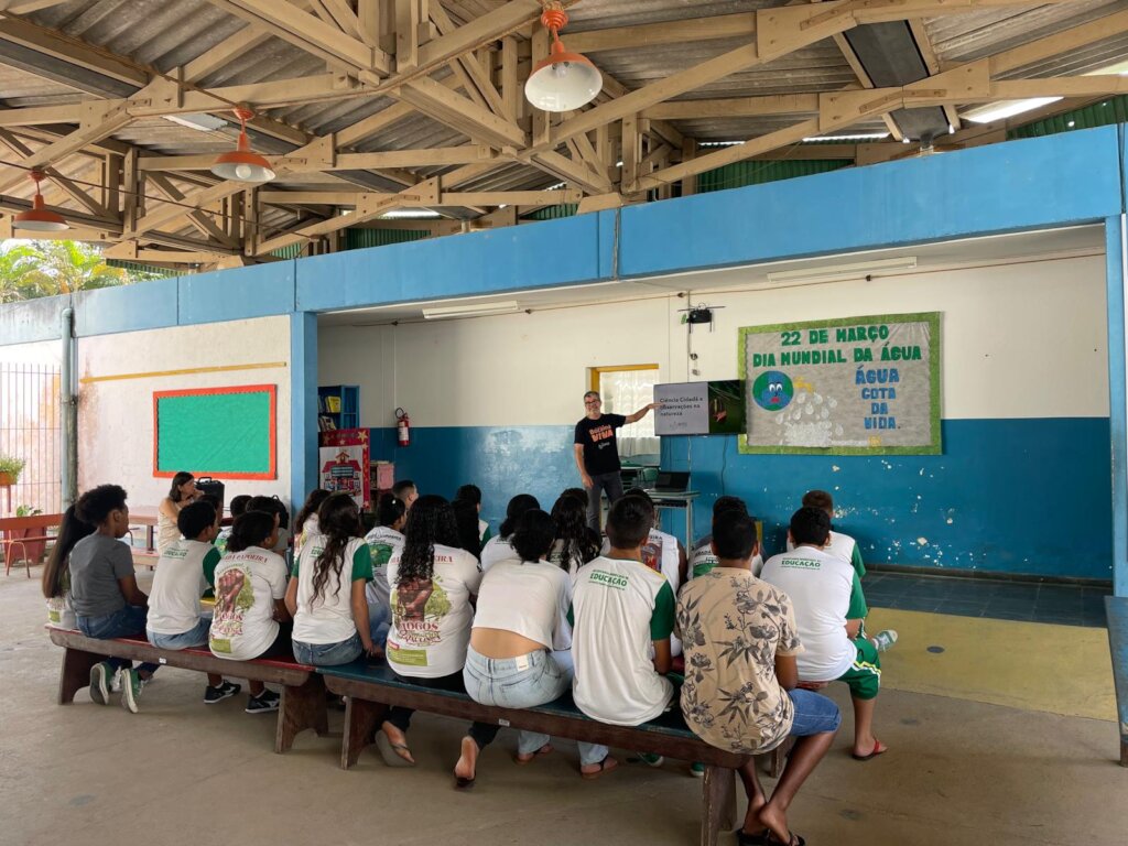
![Local students involvement - Citizen Science]()
Local students involvement - Citizen Science
Four months into the Atlantic Forest Biodiversity Monitoring project we have established the technical and social foundations needed to scale systematic monitoring across Serra da Bocaina, to protect endangered species and to engage local communities. We acquired key equipment, completed initial field monitoring trips, produced the first land cover and target areas maps, and engaged local schools and teachers in early activities. The project was planned and is executed in partnership with RPPN Candeia (Private Reserve of Natural Heritage), and is partially funded by an international conservation fund. It has not yet received substantial additional donations and future funding is needed to analyze and communicate first results at scale and to expand community involvement.
Progress to date
Equipment and logistics
- Acquisitions: One operational drone and several trail cameras purchased and fieldtested.
- Pending: Additional acoustic recorders and more camera traps remain to be procured as funding allows. Administrative costs are being postponed.
- Logistics: Transport routes and basecamp procedures established for safe, repeatable access to target sites.
Field monitoring
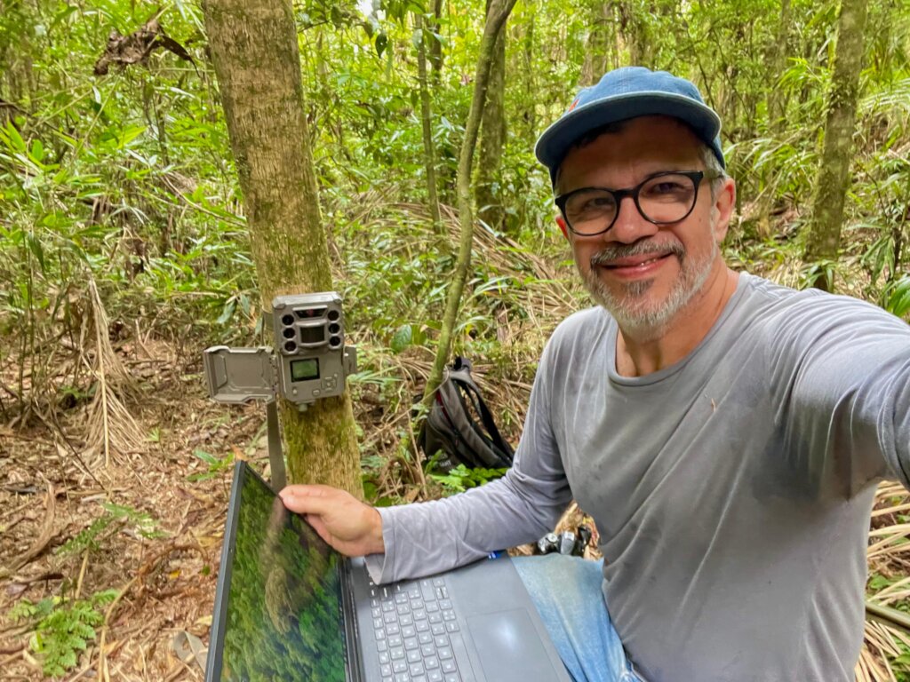
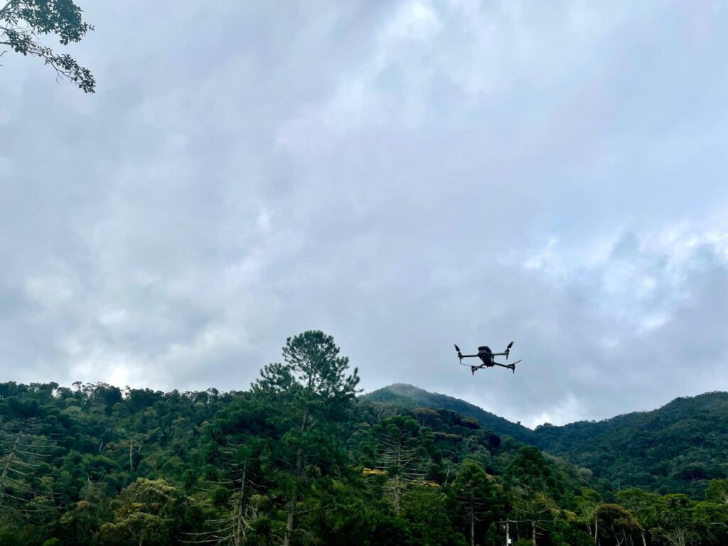
- First monitoring trips: Teams completed initial deployments of trail cameras and drone surveys at priority sites across Serra da Bocaina.
- Field protocols: Standardized camera placement, drone flight plans, and data logging templates were trialed and refined.
Mapping and spatial analysis
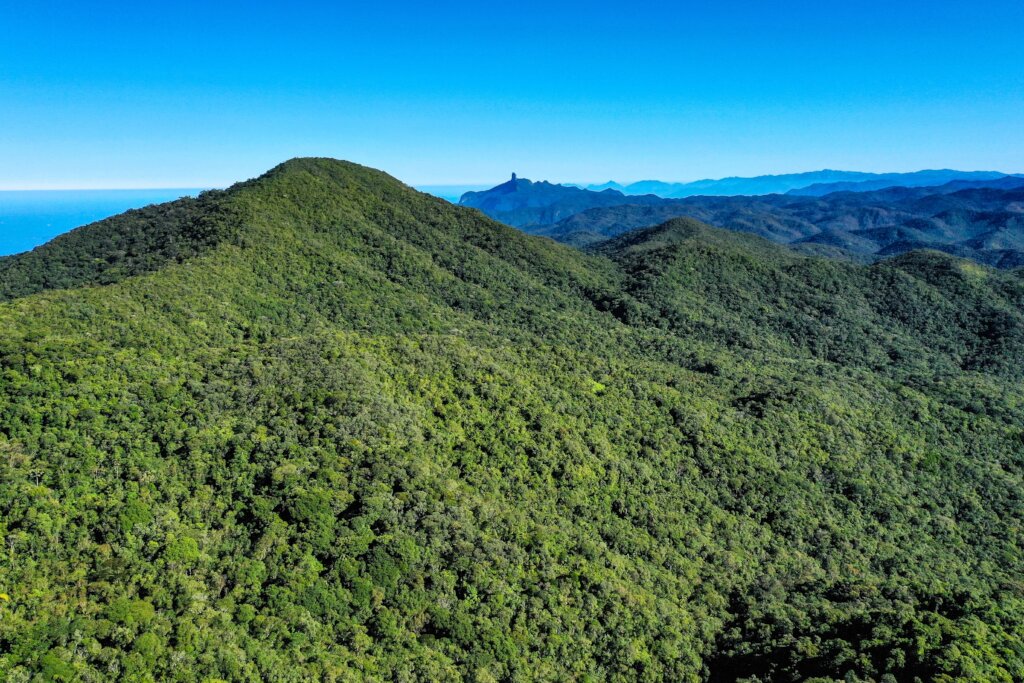
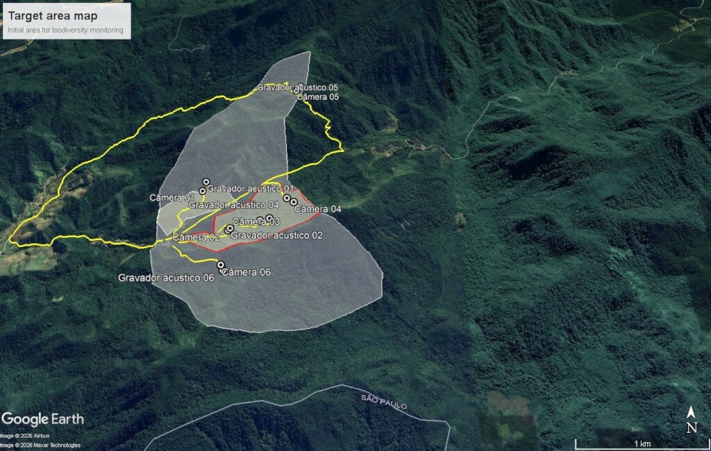
- Target area mapping: We produced land cover maps and species distribution maps to prioritize monitoring locations and corridors.
Community engagement and capacity building
- Local schools: Students from nearby schools participated in field visits and basic monitoring demonstrations.
- Teachers: Public school teachers attended introductory workshops on biodiversity monitoring tools and data interpretation.
Early observations and outputs
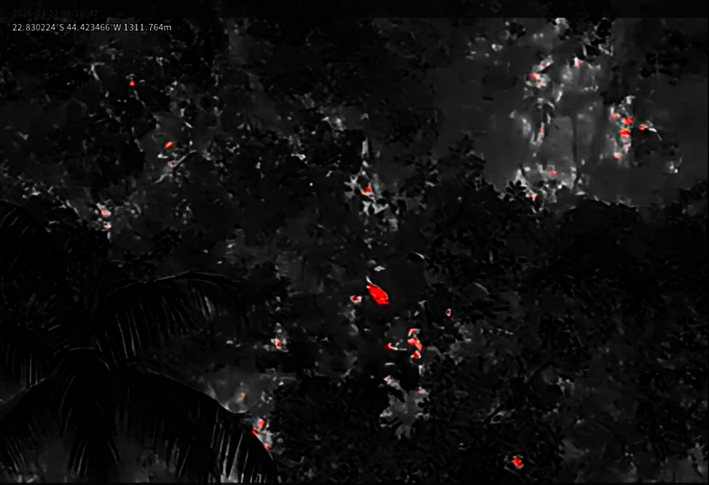
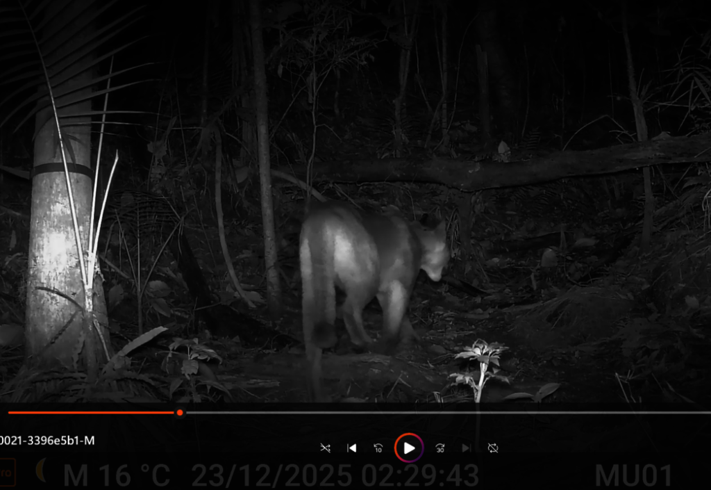
- Operational proof of concept: Drone flights and camera traps functioned reliably under local conditions, data collection workflows are viable.
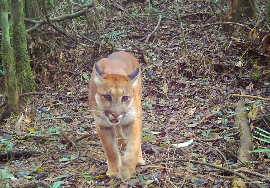
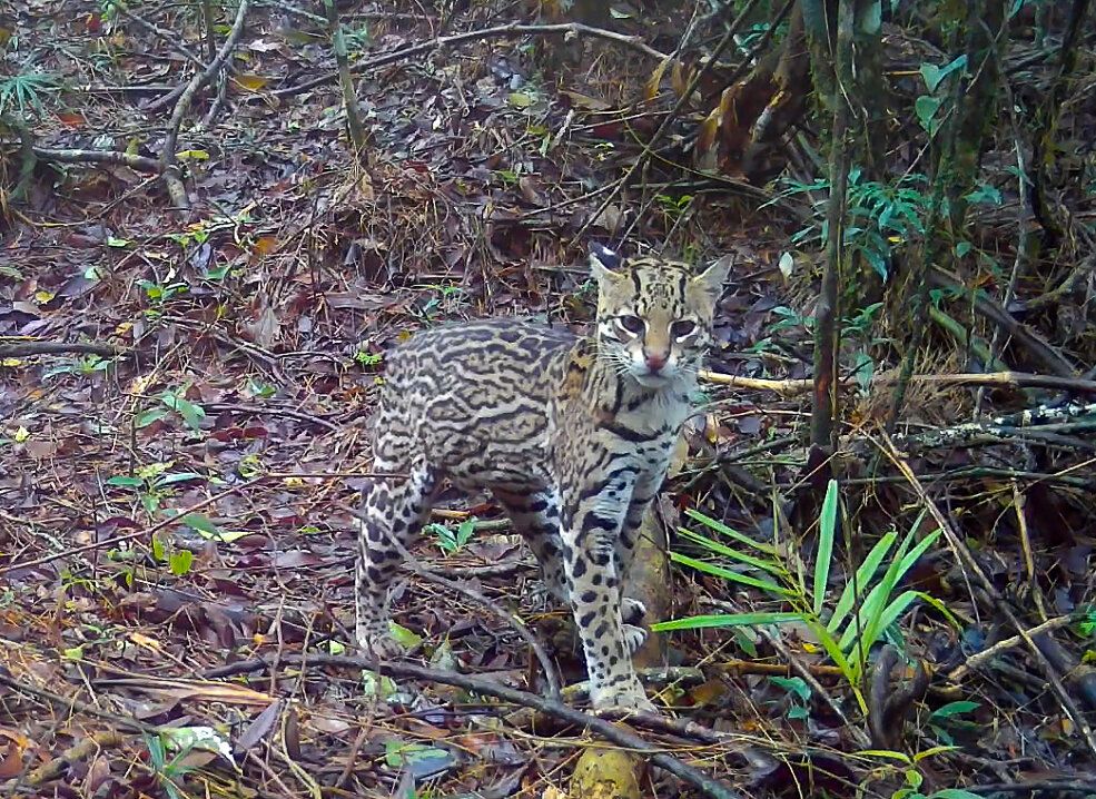
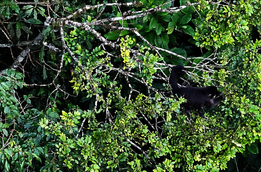
- Preliminary sightings: Early camera trap images and drone imagery captured evidence of native terrestrial fauna and habitat structure (data currently being catalogued).
- Data readiness: Raw datasets and maps are organized for analysis, full species identifications and acoustic analyses are pending additional equipment and analyst time.
Funding status and implications
- Current funding: Partial funding secured from an international conservation fund covering initial purchases and fieldwork, showing the importance of this project.
- Shortfall: No substantial additional donations received yet. This constrains procurement of acoustic recorders, additional cameras, and dedicated dataanalysis capacity, as well as covering of administrative costs.
- Impact: Without further funds we will delay comprehensive analyses, broader community training, and public communication of results.
Next steps
- Scale monitoring: Procure remaining equipment (acoustic recorders, additional cameras) and expand deployments to priority sites identified in maps.
- Data analysis: Complete species identifications, acoustic processing, and threat trend analyses; prepare first technical brief.
- Community training: Run handson workshops for local community members and teachers to operate equipment and manage basic data.
- Communication: Produce a public summary of initial findings and a donorfacing impact brief once analyses are complete.
- Partnerships and fundraising: Launch targeted outreach to potential donors and institutional partners to secure funds for year two.
Closing note
The first four months have validated our approach and built local momentum. With additional funding and partner support we can convert the promising early data into actionable conservation outcomes, deepen community stewardship, and scale monitoring across the Serra da Bocaina landscape, protecting endangered species endemic to the Brazilian Atlantic Forest.
![Drone flight in target area]()
Drone flight in target area
![Target species detection with thermal camera]()
Target species detection with thermal camera
![Biodiversity monitoring with trail cameras]()
Biodiversity monitoring with trail cameras
![Target area mapping]()
Target area mapping
![Visual detection of target species with drone]()
Visual detection of target species with drone
Links:
![Share on Twitter]()
![Share on Facebook]()