By Vidal Rondan | Project Leader
Dear donor,
Our "Restoration of Ancestral Water Management Technologies" (RETAMA) project proposes intervening in seven high Andean communities that own ancient water management infrastructures and currently preserve their ancestral uses and customs. The communities are located as follows: two in Ancash and five in the highlands of Lima.
This report details the activities carried out in the "Pamparomas" Campesino Community in the Cordillera Negra in the department of Ancash, under the role of facilitator of the participatory process and continuous learning to ensure that these communities own the problems and solutions according to their needs and realities.
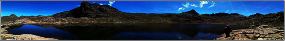
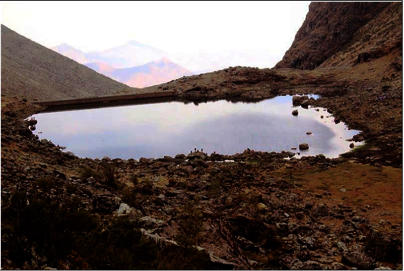
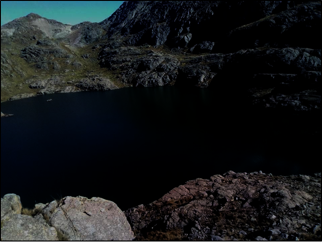
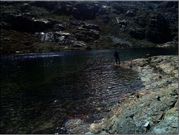
1. An ancestral irrigation canal, a dam, or a dike from the restored lagoons uses indigenous knowledge and technology to ensure water supply by compensating for the loss of glaciers.
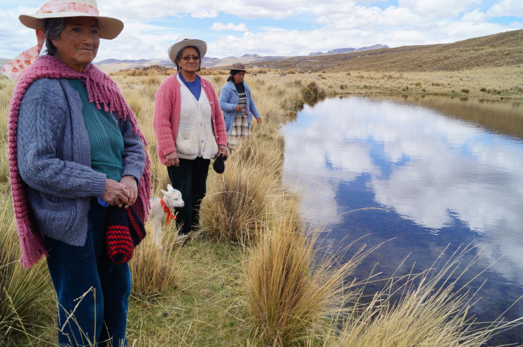
During this period, we have begun to gather information on ancestral water management infrastructures with the leaders and citizens of the Pamparomás Campesino Community. To this end, workshops, field visits, interviews, and participatory mapping have been conducted with female and male leaders.
The Pamparomas Campesino Community is one of the communities on the western flank of the Cordillera Negra mountain range, located in the Department of Ancash, province of Huaylas, and district of Pamparomas. It is currently made up of 400 members, the majority of whom are men. Women are accepted as representatives of their families as long as they are widowed, separated, or single.
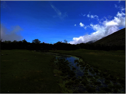
As a result of this participatory work, important natural water sources and ancestral works have been identified. The main water sources in the community are the high Andean lagoons that then descend through watercourses such as the Uchpacancha ravine, as well as the Buys Huran, Shishu Huran, and Allmay ravines, among others. To a lesser extent, some springs or "ojos de agua" are used to provide water during the rainy months and a few months after the rainfall.
2. Local ancestral knowledge of water management and its revalorization as a cost-effective and nature-based adaptation of mountains to climate change.
As part of this objective, a collective reflection on the importance of climate and the value of ancestral technologies for channeling water and especially for the use of water for agricultural and livestock activities was carried out. The following are some of the conclusions drawn from this exercise.
High zone (3500 to 4900 meters above sea level): More precipitation during the year, especially between December and April. The presence of frosts between April and June affects the crops of this ecological floor: potatoes, pastures, and some cereals. There is also the presence of some hailstorms that cause detrimental effects on the crops. A singular characteristic of this floor is the almost permanent presence of fog, especially in the so-called "winter" months (between December and April), which according to the farmers, generates a higher incidence of "rancha" (Phytophtora infestans) that affects pastures and potato crops.
Middle zone (3500 to 3000 meters above sea level): Heavy rains occur during the "winter" season, but they occur in greater quantities between January and March. Occasionally, frosts may occur between April and June, affecting most crops such as potatoes, cereals, and even fruit trees. There is little presence of occasional hailstorms by zones during the rainy season that causes detrimental effects on the crops and strong winds in December and January fundamentally initiate the rains. The fog on this floor occurs mostly in the "winter" months.
Low zone (3000 to 2300 meters above sea level): Precipitation during the winter season, starting in December but in greater quantities between January and March. There is no frost and hailstorms are only occasional and very sporadic. Fog on this floor is occasionally present in the rainy months.
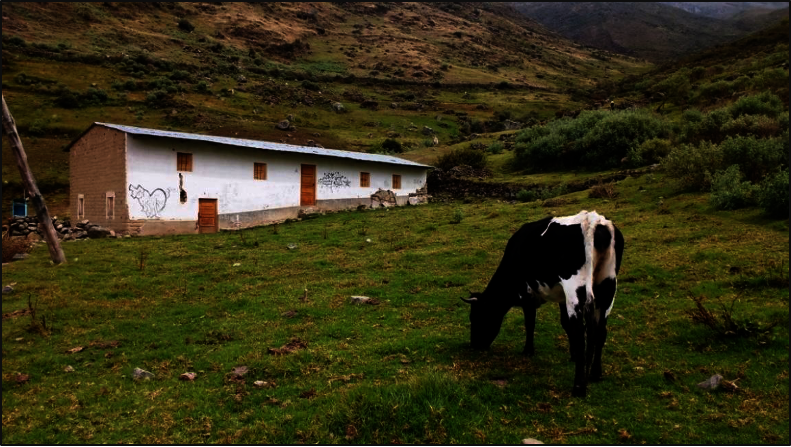
The community's main economic activity is agriculture and cattle ranching. Agricultural production is for self-consumption and, to a lesser extent, for fodder, although in the middle and lower zones, there is greater articulation with the coastal markets. In the high zone, there is no agriculture, but natural pastures are the main source of food for livestock.
Cattle ranching is the main source of basic capital for farmers in the Andean zones, as is the case in most of the Pamparomas micro-watershed. It is worth noting that the upper sectors of Racratumanca and Uchpacancha are intensely cattle-raising areas, where although it is not extensive, the community members benefit from dairy products and their derivatives such as cheeses that are in high demand in the coastal markets. In the middle sectors of Pampap and Pamparomas, livestock is diversified between cattle and sheep; however, in the lower sector of Llacta, goats and cattle predominate.
It is these communal livelihoods that have links to the water where the ancestral technologies of canals, dams, and the natural reservoir described above have been located.
3. Next steps
The next step for the coming months will be the collective prioritization of an ancestral technology that the project, in collaboration with the community, will support in rehabilitating and putting into operation for the use of water for agriculture and livestock.
Project reports on GlobalGiving are posted directly to globalgiving.org by Project Leaders as they are completed, generally every 3-4 months. To protect the integrity of these documents, GlobalGiving does not alter them; therefore you may find some language or formatting issues.
If you donate to this project or have donated to this project, you can receive an email when this project posts a report. You can also subscribe for reports without donating.
Support this important cause by creating a personalized fundraising page.
Start a Fundraiser