By Dr. David Barton Bray | EcoLogic Board Member and Professor at FIU
There hasn’t been much good news out of Honduras recently. One of the poorest Latin American nations, it has been afflicted by a series of natural and political calamities. In 1998, Hurricane Mitch killed over 14,000 people, impacted a third of the population and did $3.8 billion in damage—three-quarters of the nation’s total GDP. Droughts followed, reducing corn and bean production by 50 to 70 percent in some years. In 2009, an elected President was overthrown by the military. And in 2014, hard times in Honduras made the U.S. news, as a stream of unaccompanied children fled to the United States.
There is, however, another Honduras, a place where—despite adversity—small, rural communities are getting on with the business of living sustainably and dealing effectively with the vagaries of extreme weather, all on a shoestring budget.
As often happens, trouble breeds opportunity: This good news story emerged from the vortex of Hurricane Mitch on the steep southern slopes below Pico Bonito National Park. It revolves around the efforts of organized communities and the leadership of one man. Carlos is the President of the Association of Water Boards of the Southern Sector of Pico Bonito National Park (abbreviated AJAASSPIB in Spanish). This tall, middle-aged cattle rancher, resembling a Hollywood Western movie star, is leading 28 communities in 14 watersheds to create a more resilient local water supply system as a hedge against the dangerously erratic weather brought by climate change.
Recovering from Hurricane Mitch
The Pico Bonito communities possessed a decades-old, poorly maintained water system with basic infrastructure that did the job: It brought water down from Pico Bonito National Park to homes and livestock. Local water boards were given charge of the system by the Honduran government, though they were mostly inactive. Then came Mitch.
“After Mitch, there was almost nothing left. The entire water infrastructure was destroyed,” Carlos told me as we walked around the Emerald Hummingbird Reserve, near Pico Bonito National Park where he was hosting a delegation from the EcoLogic Development Fund of Cambridge, Massachusetts. After the storm the Honduran government was in deep crisis. “International help began to arrive, and there arose the idea that the [water] boards could really administer the water systems,” says Carlos. “Before Mitch, the boards were created by the law, but they didn’t really function, they didn’t collect the fees, the systems weren’t maintained, and they deteriorated a lot. Then Mitch finished them off. After Mitch, we started again from zero.”
The 28 communities are located along the southern boundary of Pico Bonito National Park, in an ill-defined buffer zone below the protected summits. Pico Bonito is one of the crown jewels of Honduras’s poorly funded system of preserves. At 117,110 hectares (290,000 acres) it is the nation’s second largest park.
Topping the Nombre de Dios Cordillera mountain range, Pico Bonito shelters lush tropical broadleaf forests of mahogany and cedar, with hundreds of rare medicinal and ornamental plants. Endangered mammals roam its slopes, including anteaters, wild boars, monkeys and jaguars. Its 350 bird species make it a major destination for U.S. and European birders.
Pico Bonito forms the cornerstone of a larger protected landscape, including the Cuero y Salado Wildlife Refuge with its mangroves, Texiguat Wildlife Refuge with its cloud forest, Nombre de Dios National Park, and the desert-like Emerald Hummingbird Sanctuary where Carlos was entertaining his visitors.
Sustaining drinking water in a semi-arid land
Pico Bonito’s Caribbean side is protected both by steep inaccessible slopes and, ironically, by the banana and pineapple plantations that ring it; it receives plentiful rainfall. The southern side of the park, where AJAASSPIB works, is a different story. Here the high peaks of the Nombre de Dios Cordillera create a “rain shadow” beyond which the moisture-soaked clouds of the Caribbean do not pass; this leeward slope receives a small fraction of the rain of the windward side.
Here the 28 water-stressed communities have banded together in the Association of Water Boards. “With help from the Pico Bonito National Park Foundation and EcoLogic, we developed statutes and rules—administrative systems designed for the needs of each community,” Carlos explains. The communities all agreed, “for example, that the water should be shared fairly. It should be for human use only, not for animals. There would be a standard fee for everybody. It’s all on a voluntary basis; it’s an honor, a service to the community,” he says. A great deal of attention was put on efficient organization. AJAASSPIB pulled together all the local water boards and worked with small communities that didn’t have one.
Fito, a well-known Honduran environmentalist and one of the founders of the Pico Bonito National Park Foundation, elaborates: “After the hurricane we needed to reconstruct the water systems and the water boards. As the communities established their protected areas in their upper watersheds, we helped the areas get officially recognized as ‘protected forest and water zones.'”
The community challenge went beyond organizing and building infrastructure. In many cases, the slopes above had been heavily deforested by cattle ranching and logging. Aquifers were not being charged and streams were not running steadily.
A bigger roadblock: The watersheds all were on private lands. So the communities set out to do something truly extraordinary. They worked together to re-establish the high slopes as property held in common to protect water resources for all the local families.
Reversing the Tragedy of the Commons
Zumilda, a bespectacled, retired school teacher and AJAASSPIB treasurer explains how the rules work in the Pico Bonito communities: “If people don’t pay their [water] fee, their service is cut and they have to pay a fine. It’s a fine of $10 with a month grace time, but if they don’t pay two months, then the service is cut. The treasurer has her accounting book and registers everybody’s payments.”
But the Pico Bonito communities still faced the bigger problem of how to handle private ownership of the watersheds. They solved it by turning the steep south slopes of Pico Bonito back into a commons.
The people in each community “are buying land from their neighbors in the upper slopes. The neighbors know it’s for the benefit of everyone, and there is good consciousness. They have to negotiate with them, settle on a price. Some people ask for more, some people ask for less. There are always installment payments because people are poor,” explains Carlos, EcoLogic’s Program Officer for Honduras.
These very poor communities engaged in delicate negotiations with their neighbors and painstakingly assembled pieces of land to protect the precious water supply. Today, they are real estate developers with a community mission: putting together a big enough property to assure reliable freshwater for themselves and future generations.
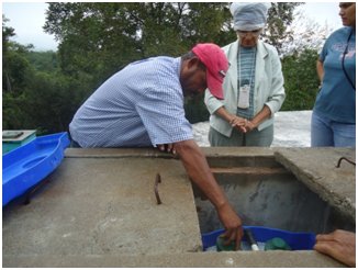
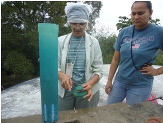
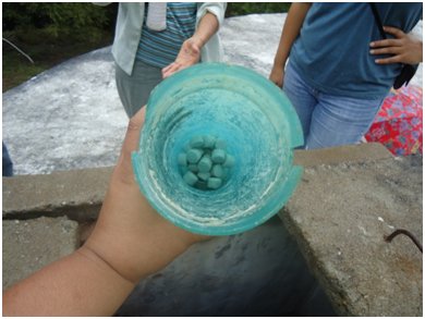
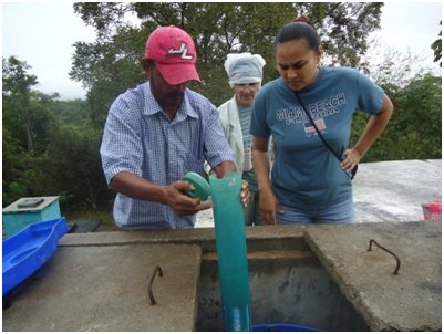
The fragmented private properties have been assembled into a common property belonging to the entire community. So far, AJAASSPIB has extended its reach to 14 micro-watersheds and 28 communities. Nine community-protected areas—ranging in size from 52 to 1,193 acres—are now recognized by the Honduran government. Total protected watershed lands top an impressive 5,453 acres. Restored forests are now growing on the formerly degraded lands, extending habitat for species found in the national park. The communities have established regular watershed patrols made up of residents to prevent tree cutting, clean intake pipes and check on storage tanks.
Managing watersheds, strengthening communities, setting an example
The cooperative process initiated by AJAASSPIB has unified the communities it serves; collections of households with traditional ties are developing into a close-knit organization with a common purpose. This success hasn’t gone unnoticed by neighboring communities.
“That a water board is active, that [it] is taking care of the system, that [it] is dealing with community problems—that strengthens the community,” says Carlos. “It can even affect other communities. When one community sees what another is doing… they want you to come help them.”
Establishing the inter-community water partnership has been slow going. It started after Hurricane Mitch, but AJAASSPIB wasn’t formed until 2006, and only now is it seeking formal legalization. But the results are clear. A string of community-protected areas now exists along the southern buffer zone of Pico Bonito National Park, with ongoing reforestation and monitoring by the communities, who also keep an eye on the park.
The accomplishments of AJAASSPIB have gained international notice. In 2011, Swiss Re named the AJAASSPIB-EcoLogic partnership the runner-up recipient for its ReSource Award for Sustainable Watershed Management. In 2012, it won one of the Equator Prizes offered by the United Nations Development Program (UNDP). In 2013, it was one of ten finalists for the Solution Search: Adapting to a Changing Climate contest sponsored by The Nature Conservancy and Rare. In 2014 it won the first Innovation Prize given by the Yale chapter of the International Society of Tropical Foresters. Zumilda, the retired school teacher, traveled to New Haven, Connecticut to receive the prize.
Lessons learned by the Pico Bonito communities are being applied in the larger landscape. Today, the Alliance of Municipalities of Central Atlantida (MAMUCA)—located between Pico Bonito and the Texiguat Wildlife Refuge in what is called the PIBOTEX corridor—is strengthening local water boards to manage their watersheds.
EcoLogic and AJAASSPIB have also entered into an agreement with the municipality and town of Olanchito, with nearly 80,000 inhabitants, to help them protect the city’s 17,550-acre Uchuapa-Pimienta watershed. The first step, as at Pico Bonito, was to organize neighborhood water boards in the city.
All of this comes none too soon, as Honduras begins to feel the escalating impacts of climate change. “Within living memory, important deviations from the average climate have been observed in Honduras,” notes a recent UNDP report, perhaps understating the reality. In the 1990-2009 period, Honduras ranked as the third-most-affected country by extreme weather events globally. Over that period, 53 events killed more than 300 people per year on average, with annual economic losses of some 3 percent of GDP. Climate scientists project a hotter drier future for much of Honduras, but with more intense and damaging rainfall events, and more intense hurricanes.
Elsewhere in Honduras poverty and violence still reign. But the Pico Bonito National Park communities, though still poor, have learned a great lesson. They are now richer in their capacity to work together, with a more resilient organization and infrastructure to assure that their water supply can withstand the storms and droughts of the future. EcoLogic is proud to work with AJASSPIB, all thanks to your continued support.
Project reports on GlobalGiving are posted directly to globalgiving.org by Project Leaders as they are completed, generally every 3-4 months. To protect the integrity of these documents, GlobalGiving does not alter them; therefore you may find some language or formatting issues.
If you donate to this project or have donated to this project, you can receive an email when this project posts a report. You can also subscribe for reports without donating.