By David Bartecchi | Director
We are happy to announce the launch of latest version of the Lakota Lands Information System. This latest system is the largest upgrade yet with an entirely knew user interface and mapping engine and would not have been possible without your support!
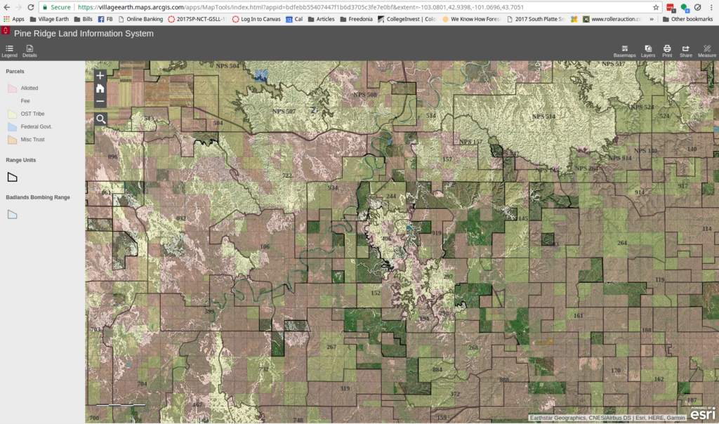
The Pine Ridge Land Information System (PRLIS) is a web-based land information system designed to assist members of the Oglala Sioux Tribe to access information about their lands and resources. The PRLIS was developed Village Earth (a 501(c)(3) not-for-profit in partnership with the Oglala Sioux Tribe Land Office and made possible with support from the Indian Land Tenure Foundation.
The PRLIS makes it possible for members of the Oglala Sioux tribe to:
With this information, land owners are empowered to better monitor and make informed decisions about the management and control of their lands. For more information about the options available to Lakota land owners such as writing a will, land exchange and consolidation, appraisals, gift deeds, right-of-way, and more visit: “Cutting through the Red Tape,” an online resource information resource developed by the Indian Land Tenure Foundation and Village Earth.
Layers include:
Parcel Layer
The parcel layer is from 2010 and is symbolized based on majority ownership. Pink for allotted lands (lands with majority ownership held by individual American Indians, brown for lands where the Oglala Sioux Tribe holds majority ownership and blue indicates lands that have a fee simple title. These lands, some of the most productive farm lands on the Pine Ridge, were originally allotted to individual members of the tribe but were quickly alienated through a process caled forced fee patenting and sold to Euro-american settlers through known as Forced Fee Pateting, a practice that was ended in 1934 because of the negative impact it had on Tribes across the country.
Range Units
Range units are defined areas of land on Native Americans that are leased, in many cases to non-Natives by the Bureau of Indian Affairs (BIA) for farming, ranching and other purposes. The BIA then distributes a portion of the revenue collected from those lands to the hundreds or thousands of individual Native American and Tribal government who own interests in lands within each range unit. (Read history here)
According to the USDA 2012 Census of Agriculture for American Indian Reservations, the market value of agriculture commodities produced on the Pine Ridge Reservation in 2012 totaled $87 million. Yet, less than 1/3 ($24 million) of that income went to Native American producers.
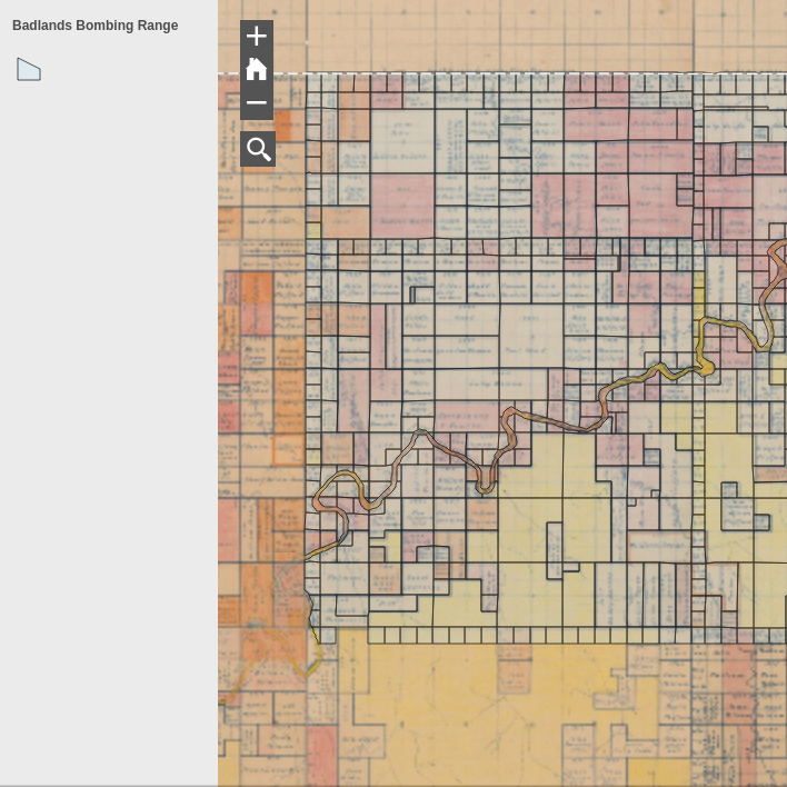
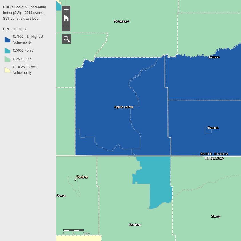
Original AllotmentsThis is a digitized and georectified version of the original allotment map of the Pine Ridge Reservation. The map contains the original allotments along with the names of the original allottees as well as hand drawn notes and color-coding to designate different classes of lands. Until now, this information was not available to members of the tribe and over the years, many people have asked us to try get this information for them so they can can begin to reconstruct the history of their lands, especially lands liquidated by the Federal Government through a process known as forced fee patenting. The creation and issuing of allotments began on the Pine Ridge Reservation in 1904, under Executive Order of July 29, 1904 and continued until 1923. During this period, government officials carved up the Reservation into parcels and issued them to Lakota families.Historic Treaty BoundariesThe PRLIS includes layers with the historic boundaries described in the Treaties of 1851, 1868, 1877 and 1910.Three Mile BufferThe PRLIS includes a layer that includes a three-mile buffer around the major towns on Pine Ridge. This information is valuable for Tribal members wanting to exchange their fractionated interests of land for a contiguous piece of Tribal land. According to Tribal Ordinance 85-17, Tribal land cannot be exchanged if it is surrounding the townsite of Pine Ridge and the established villages within a radius of 3 miles of such settlements.Badlands Bombing RangeOn July 20, 1942 the War Department advised the Commissioner of Indian Affairs that they would be taking over an area of 40×15 miles across the northern portion of the reservation. While a small portion of this land lay within what was then Badlands National Monument (337 acres), the vast majority of the land was located within the boundaries of the Pine Ridge Reservation (nps.gov). The dispossession would impact some 125 Oglala families. And while the dispossessed families were to be supplied with some relocation compensation, assistance and supplies, actual accounts vary as to how much the families received if any at all.CDC Social Vulnerability Index2014 overall SVI, census tract level. The Social Vulnerability Index (SVI) uses U.S. Census data to determine the social vulnerability of every census tract. The SVI ranks each census tract on 15 social factors, including poverty, lack of vehicle access, and crowded housing, and groups them into four related themes.
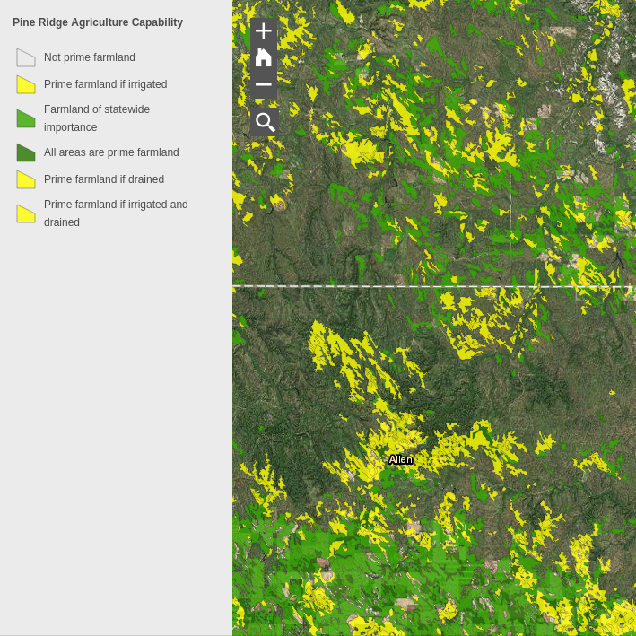
Average Life ExpectancyInstitute for Health Metrics and Evaluation (IHME). United States Life Expectancy Estimates by County 1985-2010. Seattle, United States: Institute for Health Metrics and Evaluation (IHME), 2013.United States 1862Civil War map from the David Rumsey Historical Map Collection- “Confederacy green, North red, border states yellow. A pasted down sheet in the bottom margin explains the color coding and gives population statistics for the three regions. There is an ad for “Colton’s…Complete Series of War Maps” on the verso of the cover and a pasted down list of Union and Confederate Political and Military leaders on the verso of the map.” Note: “Proposed Wagon Road” in north section of Pine Ridge Reservation.Prime Agriculture LandsThis layer is from the NRCS’s SSURGO dataset and identifies land that has the best combination of physical and chemical characteristics for producing food, feed, forage, fiber, and oilseed crops and is also available for these uses. It has the soil quality, growing season, and moisture supply needed to produce economically sustained high yields of crops when treated and managed according to acceptable farming methods, including water management. According to a study conducted by Village Earth, even though fee lands account for less than 31% of lands on Pine Ridge they occupy over 53% of the prime agriculture lands. This data suggesting that the issuance of fee patents prior to 1934 was not random but rather a mechanism to liquidate prime Reservation lands to Euro-american settlers.Tiyospaye CommunitiesAfter the establishment of the Pine Ridge Reservation the different Tiyospayes (bands that made up the Lakota) settled along the creeks which flowed off the White river. Leadership responsibilities within the Tiyospayes were centered in a camp council composed of band chiefs, headman, war leaders, active warriors and holy men (Price 1991). The different Tiyospayes organized in this way until the early 1960s when, despite great opposition, HUD and the Tribal government at the time built housing projects across the Reservation. The Tiyospaye communities still exist today but, with a few exceptions, aren’t recognized in any formal way by the Oglala Sioux Tribal Government.
Links:
Project reports on GlobalGiving are posted directly to globalgiving.org by Project Leaders as they are completed, generally every 3-4 months. To protect the integrity of these documents, GlobalGiving does not alter them; therefore you may find some language or formatting issues.
If you donate to this project or have donated to this project, you can receive an email when this project posts a report. You can also subscribe for reports without donating.