By David Bartecchi | Director
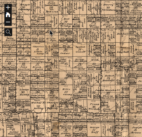
The Lakota Lands Recovery project has been pretty busy this fall. We've been focusing a lot of effort on our research of "fee" lands on the Pine Ridge Reservation and the impact that this has had on the Oglala Sioux Tribe's sovereignty and self determination. We've also been busy adding resources to our online mapping system for the Pine Ridge Reservation http://lakotalands.net, specifically, we've added county maps for Bennett, Jackson, and Oglala Lakota counties. These maps help mebers of the tribe understand who owns and controls fee lands on the Reservation. We've also added a historical allotment map of Bennett County which is part of our broader effrots to help residents "audit" their lands - specificlaly to discover where their families original allotments were located and then be able to trace changes in ownership over time - and in some cases, discover when those lands were liquidated through forced fee patenting or other nefarious mechanisms. One of the tools wer'e most excited about is linking the BLM's land patent database to each parcel on the Pine Ridge Reservation. This makes it possible for residents of the Reservation to discover the exact year and in some cases, the justification used to issue their ancestors fee patents. We are now working with this data to develop an animated map of land loss on Pine Ridge and will announce it as soon as it's available.
We want to thank you all for your ongoign support of our efforts to protect and recover Lakota lands.
Links:
Project reports on GlobalGiving are posted directly to globalgiving.org by Project Leaders as they are completed, generally every 3-4 months. To protect the integrity of these documents, GlobalGiving does not alter them; therefore you may find some language or formatting issues.
If you donate to this project or have donated to this project, you can receive an email when this project posts a report. You can also subscribe for reports without donating.